The Future of Sherwood’s Past
Why Sherwood Forest?


Visitors since 7th November 2013
Mercian Archaeological Services CIC
Community Archaeology in the East Midlands,
Community Archaeology Nottinghamshire, Excavation, Research, Volunteering, Community
Archaeology Derbyshire, Training, Social, Learning, Community Archaeology Leicestershire,
Heritage, Involvement, Belonging, Knowledge sharing, Community Archaeology Lincolnshire,
Topographic Survey, Talks and Presentations, Outreach, Archaeology Projects , Open
Days, Schools, Finds Processing, Day Schools, Field Schools, Young People, Archaeology
and History of Sherwood Forest, Pottery Research, Medieval, Roman, Prehistoric, Community
Interest Company, Community Archaeology Nottinghamshire.
Community Archaeology in Nottinghamshire
Community Archaeology in Derbyshire
Community Archaeology in Leicestershire
Community Archaeology East Midlands
Community Archaeology in Lincolnshire
© Mercian Archaeological Services CIC 2013. Registered Business No. 08347842. All Rights Reserved.
Sherwood Forest was situated entirely within the county of Nottinghamshire, in the English Midlands.
Almost exactly in the centre of England.
There were many reasons why it was considered an ideal location for a Royal Forest when it was established sometime in the early Norman period.
Some of these are outlined below.
Geology
The area north and west of the Trent was an ideal location for a forest, especially the area of the Sherwood Sandstone geology
These Permo-
This lack of fertility resulted in less arable cultivation of this sandstone region. Domesday book of 1086 show this area to be far lower in arable land use than the corresponding areas of the Mercia Mudstones and the highly fertile area of the Trent valley.
Domesday book shows the whole of the area north and west of the river Trent to be dominated by Wood-
Place name evidence
This landscape of trees, pasture and open heathland can be traced back beyond Domesday and the Norman conquest.
Placename evidence presumed to date from the Dark Ages suggests this area was characteristically well wooded.
The placename ending 'ley' is thought to indicate a clearing in woodland.
The placename field as in 'Ashfield' suggests an area of open heathland.
It is noticeable that all of these are north and west of the river Trent
Crown possessions
As well as the natural state of the land, another crucial reason for choosing Sherwood was that the crown had a significant influence in the area.
The Royal manors of Arnold, Bothamsall, Dunham, and Mansfield (the largest manor in the county in the medieval period) were all north and west of the river Trent.
All these elements combined to make this area an ideal location for a royal hunting forest.
Deer love woodland and heathland-

Click on the image below to see the project blog:

Award Winners 2016
for "Engaging people in the heritage, history & archaeology of Sherwood Forest".
Official Sherwood Forest Archaeology Project T-
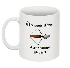
Official Sherwood Forest Archaeology Project Coffee Mug for just £8.50 +p&p
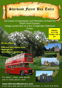
World-


Project page links:
-
-
-
-
-
-
-
-
-
-
-
-
-
-
-
-
-
-
-
-
-
-
-
-
-
-
-
-
