- Open area excavations
- Test pitting projects
- Ploughsoil Test-
Pitting - Geophysical surveys; Ground Penetrating Radar, Magnetometer, Resistance
- Topographic surveys
- Level 1 Survey and LiDAR Groung-
truthing - Fieldwalking
- Photogrammetry, LiDAR processing, Astronomical surveys
- Historic mapping & Documentary Research
- Specialist Finds Analysis and Reporting
- Documentary and archival research
- Museum archive consultancy
- Geographic Information Systems (GIS)
- Heritage Interpretation
- Project design, implementation, management and consultancy (See Community Archaeology)
- Funding advice and hands on support (See Community Archaeology)
- Archaeological training opportunities (see Training & Fieldschools pages)
- Full project write up and reporting (see Publications page)
- Desk Based Assessments (DBA) (see Publications page)
- Read more about Mercian and the benefits of working with us on your projects here.
We have extensive experience of the archaeology of the region, and our staff have a wide range of different but complimentary skill sets.
This allows Mercian Archaeological Services CIC to successfully approach any form of community archaeological project including:


Below are listed details of some of the Services we offer.
Please contact us for further information and to discuss anything not on the list.
We also provide commercial Archaeological watching briefs and Desk Based Assessments as part of the Planning System at very competitive rates.
Please contact us at info@mercian-

Services


Topographic Survey
Specialist Finds Analysis and Reporting
Excavation
Test-
Level 1 Walkover Survey & LiDAR Groundtruthing
Geophysical Survey
Historic Mapping & Documentary Research
Museum archive consultancy
Geographic Information Systems (GIS)
Photogrammetry, LiDAR processing, Astronomical surveys
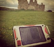
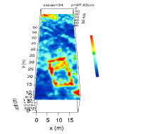
Ground Penetrating Radar (GPR)
Magnetometer Survey
Resistance Survey
Heritage Interpretation
More information about our Services:
As a streamlined Community Archaeology company, we are not burdened with the overheads associated with larger commercial companies. This has enables us to pass on cost savings to our customers and bring in added value by working with specialists.
Mercian are community archaeology company set up to undertake research work for and alongside the community. We are not a commercial archaeological company set up to work in the planning system who undertake community work alongside their main commitment to commercial work. As such our entire ethos and working practices are designed to provide community groups with the best service and value, tailored to the community archaeology field.
We bring an experienced team with a very strong community focus and a passion for sharing their knowledge and experience
A commitment to providing training and skills development and involving the community in all aspects and stages of the archaeological process
A strong research-
Extensive links with top national and regional experts and specialists, ensuring the right people are always on hand to provide the most accurate advice and interpretation of the archaeology
Firm commitment to prompt reporting of the results of the work to the client and local Historic Environment Record, along with a commitment to publishing all work, fully supported by specialist finds analysis
As a Community Archaeology company, rather than a commercial archaeology company, we specialise in providing training and learning opportunities to volunteers and villagers alike.
As a Community Interest Company our focus is on providing community opportunities and training, rather than being more focused on profit and commercial work.
As we are all experienced staff, we have excellent knowledge of local pottery and finds and can help you identify artefacts as they come out of the ground, providing a better and fuller experience for everyone involved.
We will always have our most experienced and knowledgeable staff on-
As a community archaeology company, we will always be on-
As a community archaeology company, we will never just dig while volunteers and villagers watch. This is your project, and you will be involved in all processes throughout the project.
It is essential to have the right team in place to deliver a community focused project designed around learning and involvement, but also to ensure the maximum level of information retrieval from the archaeological investigations and to ensure best value for money.
At Mercian we believe that to undertake the best possible community archaeology project a client would benefit most from employing a specialist community archaeology provider rather than a company who undertakes community archaeology as a small part of its other commercial and planning related archaeological projects. Most archaeology providers are commercial companies set up to deliver archaeological mitigation in the planning system. In contrast Mercian is a specialist community archaeology provider, and all the Mercian core staff provided to the project are specialist community archaeologists with many years’ experience in the local area.
In addition to our core staff of highly experienced field archaeologists, our extensive links with top national and regional specialists and experts mean you can be sure we always have prompt access to the right advice and expertise in order to make the right decisions and to help us to draw the correct conclusions, both in the field and during post excavation analysis and reporting, also avoiding potentially costly bad decisions such as using incorrect sampling strategies or sending unsuitable samples for scientific dating.
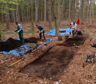
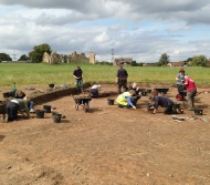
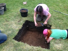
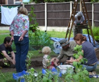
At Mercian we have a large amount of experience in archaeological excavation including open area excavation and trial trenching methods.
All our staff are highly skilled archaeologists and communicators, and our excavations are designed around Community Archaeology, Public Involvement, Training, and Research.
Please have a look at our Projects page for examples, and also our Sherwood Forest Archaeology Project Page.
Mercian operate to the highest possible standards following and often surpassing Best Practice Guidance for Research Archaeology.
Please see the guidance of the Chartered Institute for Archaeologists:
https://www.archaeologists.net/sites/default/files/CIfAS&GExcavation_1.pdf
Plough-
A fantastic option for combining community archaeology with high level research is Plough-
Mercian recommend plough-
At the Discover King John’s Palace project in 2015, 120+ people under supervision from Mercian were able to excavate over the course of 3 weeks using this method. The results have helped to demonstrate the extent and date of occupation at the medieval royal hunting complex of King John’s Palace in Sherwood Forest.
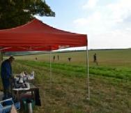
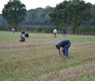
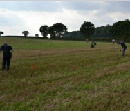
Fieldwalking
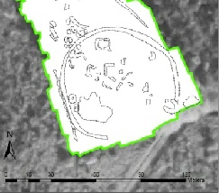
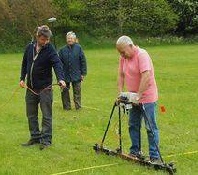
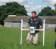
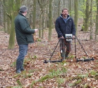
At Mercian we offer a full topographic survey solution utilising as required a combination of Differential Geographical Positioning System (DGPS), Robotic EDM Total Station, Reflector & Reflector-
We generally undertake a combination of Objective and Subjective survey techniques to create 3-
Our surveys are however tailored to your individual needs, budget, and in response to survey logistics.
Mercian and our staff have undertaken topographic survey on sites ranging from castles, to former palaces, deserted villages, and even in the Sherwood Forest National Nature Reserve.
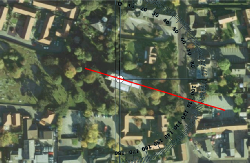
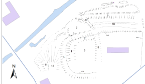
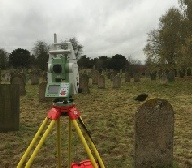
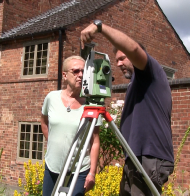
The examples to the left show a 2D hachure plan (top right) and 3D terrain model (bottom left) of a castle site. A Robotic Total Station in action (top left) and a Total Station being demonstrated to a member of the public (bottom right).
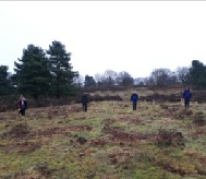
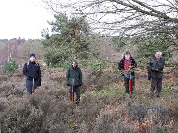
In archaeological fieldwalking, a recently ploughed field is walked in either grids or on lines (transects) to give systematic coverage of the ground surface.
The locations of archaeological finds are recorded, and the artefacts are either identified and recorded in the field and left as they are (non-
The locations of the finds is then plotted in Geographic Information Systems (GIS) software to help determine any distribution patterns in the data.
This technique is very useful for detecting archaeological hotspots, and for using alongside other
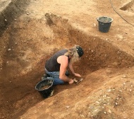
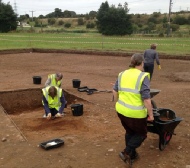
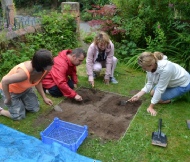
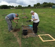
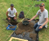
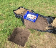
Mercian have a large body of experience in Archaeological Test-
Test Pits are 1 metre by 1m Metre square and are dug in the same way as any other excavation. Mercian always dig by context, but also combine this with digging by spit with in contexts to produce the highest quality of results. All Test-
Archaeological excavation is an invasive method, and we believe that all archaeology should be undertaken by a professional archaeologist or under the supervision of a professional archaeologist.
Mercian will not leave you to dig dozens of pits and then come along later to have a look at what has been found, we recommend against this method, and would recommend caution when this method is offered to groups by other companies. Test pits must be excavated in the correct way, and recorded to the correct level. When this is done test pits are a fantastic tool, especially in the studying of settlement development.
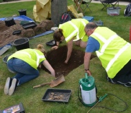
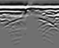
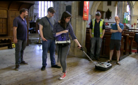
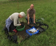
At Mercian we offer a full suite of Archaeological Geophysics techniques. These methods can help in interpreting buried features such as foundations, pits, ditches, kilns and more…
At Mercian we can provide a large range of specialist services beyond the day to day techniques usually seen in Archaeology. We have skills in a number of techniques including:
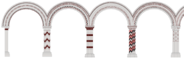
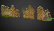
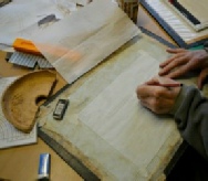
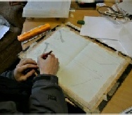
Photogrammetry. This is the science of making measurements from photographs, especially for recovering the exact positions of surface points.
It can be used to create highly detailed and accurate elevation drawings and reconstructions as seen in the image left top (the late 12th century painted arcade of St Mary’s Church Norton-
It can also be used to create accurate 3D computer models of excavations and standing remains of buildings (see King John’s Palace image bottom left).
Mercian are also skilled in Astronomical observation, horizon archaeology and the used of computer modelling to calculate historical alignments and orientations in buildings and other monuments.
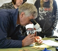
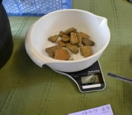
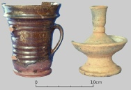
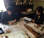
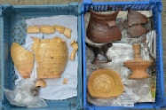
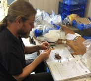
Finds processing and analysis is a highly skilled specialism and takes years of dedicated study and experience to undertake properly.
All finds from excavation, fieldwalking or any other form of archaeological work should be quantified and recorded in line with archaeological best practice.
It is essential that this is done by an appropriately skilled professional.
Mercian are skilled in finds processing and analysis. David Budge, Mercian’s Director and finds Specialist undertakes analysis of artefacts recovered by Mercian.
David’s skills are held in high regard, and he also writes specialist finds reports on behalf of other archaeological units.
Please contact Mercian if you have any finds that you would like processing or identifying.
We also (where necessary) call on a large network of other specialists to ensure that the maximum knowledge is gained from all archaeological works.
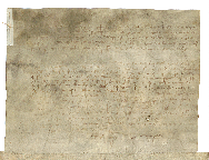
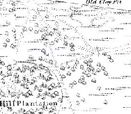
Historical maps are an invaluable resource for understanding past landscapes. Their analysis should form the back-
Historic documents including parish records and archival material is also a hive of information on past activities.
Mercian are skilled in working at the local and national archives to undertake research, working with primary, secondary and published sources. We can work with published transcribed Latin sources, micro-
More info coming soon.
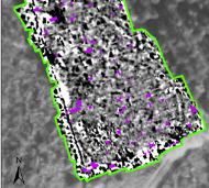
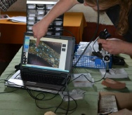
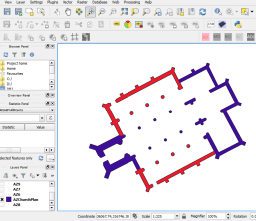
A Geographic Information System (GIS) is a system designed to capture, store, manipulate, analyse, manage, and present spatial or geographic data.
At Mercian we use GIS for many things including creating maps, analysing landscapes, understanding archaeological sites, creating 3D models, viewshed analysis, presenting survey data and more.
We are highly skilled in ArcGIS, MapInfo and QGIS software.
GIS is a great way to integrate data from projects and can be used to analyse that data as well as present it in the form of maps for publication.
The images to the left include GIS being used in building analysis, surveying, map work, and the displaying of geophysical survey data.
More info coming soon.
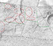
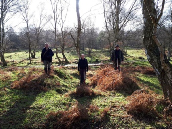
Level 1 Walkover survey is a form of preliminary archeological ground reconnaissance survey. It is particularly useful in areas of woodland, and is method of searching for and recording archaeological remains that were either previously unknown or unrecorded.
At Mercian for Level One Survey we record earthworks with GPS coordinates, photographic record, descriptions, measurements, comments, interpretation etc. These criteria can be added to to meet requirements.
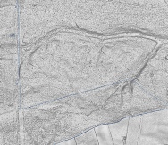
Light Detection and Ranging known as LiDAR measures distance to a target by illuminating the target with pulsed laser light and measuring the reflected pulses with a sensor. In Archaeology this method is undertaken most frequently by aeroplane. It is of great use to archaeologists as it is possible to remove (to some extent) vegetation and create a digital terrain model (DTM) of the ground surface. In this form it enables archaeologist to look for archaeological features on a computer across whole landscapes. At Mercian we are experienced in processing and analysing LiDAR data sets for archaeological remains. We are also experienced in archaeological field survey or ground-
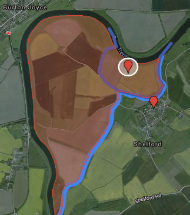
The Sherwood Forest National Nature Reserve Archaeology Survey is a long-
Community Archaeology Nottinghamshire, Community Archaeology Derbyshire, Community Archaeology Leicestershire, Community Archaeology East Midlands, Mercian Archaeological Services Community Archaeology for Nottinghamshire, Derbyshire, Sherwood Forest, Leicestershire and the East Midlands. Community Archaeology Nottinghamshire, Community Archaeology East Midlands, Community Archaeology Leicestershire. Archaeological

Mercian Archaeological Services CIC
Specialists in Community Archaeology, Public Involvement, Research & Training
Community Archaeology Nottinghamshire, Excavation, Research, Volunteering, Community Archaeology Derbyshire, Training, Social, Learning, Community Archaeology Leicestershire, Heritage, Involvement, Belonging, Knowledge sharing, Community Archaeology Lincolnshire, Topographic Survey, Talks and Presentations, Outreach, Archaeology Projects , Open Days, Schools, Finds Processing, Day Schools, Field Schools, Young People, Archaeology and History of Sherwood Forest, Pottery Research, Medieval, Roman, Prehistoric, Community Interest Company, Community Archaeology Nottinghamshire.
Community Archaeology in Nottinghamshire
Community Archaeology in Derbyshire
Community Archaeology in Leicestershire
Community Archaeology East Midlands
Community Archaeology in Lincolnshire
© Mercian Archaeological Services CIC 2019. Registered Business No. 08347842. All Rights Reserved.
Community Archaeology in Yorkshire