According to Bede, King Edwin was killed at the Battle of Hatfield on 12th October 633, and the Catholic church recognises the saint day of St Edwin as the 12th October.
Local legend states that Edwinstowe church is built on the spot where Edwin’s headless body lay after the battle, his head was later buried in York Minster and his body finally buried at Whitby Abbey. Following his elevation to sainthood the spot where his body had lain became a hallowed place.
In 1381 Richard II granted the right to the villagers of Edwinstowe to hold a vigil and feast on St Edwin’s day. A medieval vigil took place overnight from the preceding day until dawn on the saint’s day, and it is suggested here that the location of the dawn may have played a significant part in the vigil.
Edwinstowe has the meaning ‘Edwin’s Holy Place’. This report suggests that the vigil and saint’s day celebrations seen from the 14th century, combined with the presence of a ‘St Edwin’s chapel’ in the neighbouring parish of Clipstone; provides evidence of a medieval cult of St Edwin local to the area around Edwinstowe. For the orientation of the church on the sunrise of St Edwin’s saint’s day of 12th October, when the church was rebuilt in the year 1175, in the village bearing his name, and where there appears to be a medieval cult with a tradition of vigil observation and saint day feasting, to be anything other than deliberate seems somewhat unlikely.
Searching for the alignment of churches and their relationships to saints’ days and/or other celebrations such as Easter is often plagued with difficulties, due to not knowing the actual date of construction, and with no definitive date for the endowment of a church with its saint. In this instance, the church is dedicated to St Mary, but the saint day in question is not for the saint to which the church is dedicated in the medieval period. It is for St Edwin, not St Mary. The likelihood is that the association with Saint Edwin dates back to before the building of the current church and the dedication of that church to St Mary.
The link with St Edwin is believed to date back to at least the origin of the place-
Domesday lists a preceding church, and this report hypothesises that if the orientation is deliberate, then the preceding Saxon church may also have had an orientation of 106.5 ˚ azimuth. Calculations show that the same alignment was certainly correct back to at least circa 1000AD.
Earlier than this time the orientation, if deliberate, may have been slightly further to the north as circa 633AD the dawn was observed at 104˚-
Reports of the monks of Hexham observing a vigil and sunrise at the site of the battle of Heavenfield in relation to the death of Edwin’s nephew St Oswald, provide near contemporary 7th century evidence suggesting that the observance of overnight vigils was prevalent around the time of Edwin’s death. This could support the idea of a 7th century origin for the activity of orientation on, and observation of the sunrise at Edwinstowe back to the time immediately following the death of King Edwin as the battle of Hatfield in 633AD.
Place-
St Edwin was previously King Edwin. He was the first Christian King of Northumbria, who died on the 12th of October at the battle of Hatfield in the year 633AD.
St Edwin's day on the 12th October, was the anniversary of his death.
In medieval times the people of Edwinstowe kept a vigil and held a feast in the churchyard at Edwinstowe on his saints day each year.
This research helps to suggest that a cult of St Edwin was present in Edwinstowe in medieval times, and that the church there was the centre of that cult, most likely due to St Edwin's body having been buried there following the Battle of Hatfield in 633AD. The paper discusses all the evidence linking Edwin to the area of Sherwood Forest, including to the village of Cuckney where up to 200 skeletons were found in 1951, and suggests the evidence is now overwhelmingly in support of his having died in the area.
The report also gives new theories regarding the origins of St Edwin's Chapel, as part of the designed medieval romantic Arthurian parkland landscape (identified by Gaunt) surrounding the royal palatial hunting complex of Clipstone.
It also suggests new theories regarding the development of the village of Edwinstowe in Saxon and Medieval times, and suggests that Edwinstowe church may have been an important early Saxon Minster site.
This is potentially of great importance for the local area.
Please see the summary below for an explanation, and the report for a full account of the work and results.
Edwinstowe means 'Edwin's Holy Place' and report by Mercian Archaeological Services CIC, as part of the Sherwood Forest Archaeology Project, has shown that Edwinstowe church, in the medieval period, pointed at the sunrise on the 12th October, which is the saint day of St Edwin.

Read and /or download the FREE project report here:
http://www.mercian-
Edwinstowe village is the home of the Sherwood Forest National Nature Reserve, and the world famous Major Oak, legendary hideaway of the outlaw Robin Hood. For this association the village, and the wider area of Sherwood Forest are known around the world. Local legend also states that Robin Hood and Maid Marian were married in the village at the church of St Mary.
What is perhaps less well known are the numerous links tying the village of Edwinstowe to the death of the Saxon King Edwin, first Christian King of Northumbria, who was killed at the Battle of Hatfield in the year 633AD. The Battle of Hatfield was fought between the forces of King Edwin of Northumbria on one side, and the combined armies of Penda of the Kingdom of Mercia, and Cadwalla of Gwynedd on the other. The battle saw the Northumbrian’s defeated and King Edwin killed.
The battle is currently associated with the village of Hatfield near Doncaster. This report builds on the work of previous historians and on recent archaeological projects, to suggest that it is now beyond any reasonable doubt that the Battle of Hatfield and the death of King Edwin of Northumbria happened in the vicinity of Edwinstowe, Nottinghamshire.
A topographic survey of the outline of Edwinstowe church was undertaken by Andy Gaunt and Sean Crossley of Mercian Archaeological Services CIC in June 2017. The survey was undertaken to record terrestrial points in Ordnance Survey datum in order to allow empirical observations to be made regarding the orientation of the church. The results of that survey are presented in this report, alongside astronomical observations and recordings undertaken by Andy Gaunt in relation to the orientation of the church and the horizon as observed from that location.
The results of the topographic survey, combined with satellite acquired Digital Elevation data, for the surrounding landscape show that Edwinstowe church has an orientation at an azimuth of 106.5˚. Astronomical calculations show that this alignment orientates on the local horizon to the sunrise as observed on the 19th October (2017).
In Medieval times dates were calculated using the Julian Calendar. Problems relating to the differences between astronomical time and the way the calendar was calculated, meant that there was a drift of over ten days that had accrued, by the time this was corrected in the 16th century, by the introduction of the Gregorian Calendar. Britain adopted the Gregorian Calendar in the 18th century and by this time the drift had increased to eleven days. Eleven days were therefore added to the Julian Calendar dates to correct the drift (a full description of the date changes and astronomical variations are included in the report methodology section).
However, when searching for possible alignments in a building it is necessary to know when a structure was built. When Britain adopted the Gregorian Calendar, this effectively put the dates back to where they would have been if the Julian Calendar had been correct. However, by the date of construction in the 12th century the calendar had already drifted by seven days. As a result, a building aligned on the 12th of October in the 12th century will have a seven-
This alignment variation is only in relation to the calendar date, and not to astronomical events themselves. It only affects alignments based on a particular date, such as sunrise on a particular saint day. It does not affect Solstice or Equinox alignments.
The church at Edwinstowe was rebuilt under the orders of Henry II in the year 1175. Astronomical observations show that on the 12th October 1175 the sunrise took place on the local horizon precisely between 106˚-

Sunrise on 12 October 1175AD calculated using Stellarium Software, and local horizon calculations using Horizon Software, based on the coordinates for Edwinstowe Church. © Mercian Archaeological services CIC 2017
With the centre of the cult of St Edwin focusing on Edwinstowe church, an alternative origin for the chapel of St Edwin located in the neighbouring lordship of Clipstone, and endowed by King John in 1205, is presented. It is suggested here for the first time that the chapel of St Edwin originated as part of the newly-
Chapels and hermitages, as well as performing a religious role, were also an important ingredient in Arthurian and other romance literature of the day and formed a common element in designed romantic hunting landscapes. By linking to the local legend and cult of St Edwin the chapel would have been an expression of piety, but would also have had a special level of romance that resonated from the site and the association.
It is suggested here that the Chapel of St Edwin is one such parkland chapel, founded to reference the local cult of St Edwin, and that this suggests a deliberate romantic theme. It also takes elements of the origin of the designed romantic Arthurian landscape of Clipstone back to the late 12th to early 13th century, which included the formation of the Deer Park and Great Pond of Clipstone in the later 12th century.

Learn about the Battle of Hatfield and Mercian’s project there with the Battle of Hatfield Investigation Society:
Does the Heritage of the Welbeck Estate Include A King Killed At Cuckney? Click here
Read and/or download the project report FREE here:
An Integrated Archaeological Survey of Cuckney Churchyard, Castle, and surroundings. Cuckney, Nottinghamshire, 2016. Archaeological Report [94.9MB].


The linking of the chapel to St Edwin of Northumbria, by the Kings at Clipstone, strengthens greatly the probability of a local cult of St Edwin, centred on Edwinstowe. This helps to bridge the gap between the 1381 reference to the vigil and saint day feast in the village, and the rebuilding of the church in 1175 (which orientates with Edwin’s saint’s day sunrise).
Further to the above is the presence of a church in Edwinstowe in the Domesday Book. This church and its medieval parish (which covered much of the surrounding villages and landscape) could represent the fossilisation of an early minster site at Edwinstowe (due to its early importance and direct links to St Edwin of Northumbria).
All this evidence combined makes it almost certain that Edwinstowe was the home to a medieval cult centred on St Edwin, whose former life as King Edwin of Northumbria came to an end near Edwinstowe in the year 633AD.
As mentioned above local legend states that Edwinstowe church is built on the spot where Edwin’s headless body lay after the Battle of Hatfield, and, following his elevation to sainthood the spot where his body had lain became a hallowed place. The Battle of Hatfield was fought between the forces of Edwin of Northumbria on one side, and the combined armies of Penda of the Kingdom of Mercia, and Cadwalla of Gwynedd on the other. The battle saw the Northumbrian’s defeated and King Edwin killed.
It is just possible that the church in Edwinstowe and its original orientation on the sunrise on his saint’s day on 12th October is in fact a very visible reminder of King Edwin of Northumbria (later St Edwin) and his death at the Battle of Hatfield in the vicinity of Edwinstowe in the 7th century.
When research is centred and rooted in a locale it really can begin to bring forward exciting discoveries.
This project has emerged from a combination of many of the different projects that Mercian Archaeological Services CIC are undertaking in Sherwood Forest (many of them involving the public and archaeological community volunteers) including our work at King John's Palace, Cuckney village and the Battle of Hatfield related research going on there, Edwinstowe Village (Mercian's Robin Hood's Village Dig), and our ongoing research at the site of St Edwin's Chapel.
It is only through such long-


Photo: Cuckney Church -
Photo: The site of St Edwin’s Chapel in Sherwood Forest.
© Mercian Archaeological services CIC 2016
Photo: Edwinstowe Church in Sherwood Forest. © Mercian Archaeological services CIC 2017
Project page links:
-
-
-
-
-
-
-
-
The Sherwood Forest
National Nature Reserve Archaeology Survey
-
Long term Research at
King John’s Palace:
Ancient Royal Heart of Sherwood Forest
-
The Sherwood Forest Archaeology Training Fieldschool
-
“Scirwuda-
Ghost and Shadow woods of Sherwood Forest Project
-
Investigating Thynghowe Viking
Meeting Site
-
Searching for the
The Battle of Hatfield
-
-
Fieldswork at St Edwin’s Chapel
-
St Mary’s Norton-
-
Mapping Medieval Sherwood Forest
-
The Sherwood Forest LiDAR
Project
-
Warsop Old Hall
Archaeological Project
-
The Sherwood Villages Project:
Settlement Development in the Forest
-
-
-
Researching Edward IIs fortification at Clipstone Peel
-
-
-
-
The Cistercians of Rufford Project:
Settlement Development, Dynamics and Desertion.
-
Sherwood Forest Environmental Survey
-
World War II in Sherwood Forest -
-
World War I in Sherwood Forest -
-
About Medieval Sherwood Forest
-
Robin Hood and Sherwood Forest
-
-
-
-
-
-
-
-
-
-
-
-
Community Archaeology in Derbyshire
Community Archaeology in Leicestershire
Community Archaeology Nottinghamshire, Excavation, Research, Volunteering, Community Archaeology Derbyshire, Training, Social, Learning, Community Archaeology Leicestershire, Heritage, Involvement, Belonging, Knowledge sharing, Community Archaeology Lincolnshire, Topographic Survey, Talks and Presentations, Outreach, Archaeology Projects , Open Days, Schools, Finds Processing, Day Schools, Field Schools, Young People, Archaeology and History of Sherwood Forest, Pottery Research, Medieval, Roman, Prehistoric, Community Interest Company, Community Archaeology Nottinghamshire.
Community Archaeology in Nottinghamshire
Community Archaeology East Midlands
Community Archaeology in Lincolnshire
Community Archaeology in Yorkshire
Mercian Archaeological Services CIC
Specialists in Community Archaeology, Public Involvement, Research & Training
© Mercian Archaeological Services CIC 2024. Registered Business No. 08347842. All Rights Reserved.


The Future of Sherwood’s Past


Community Archaeology Nottinghamshire, Community Archaeology Derbyshire, Community Archaeology Leicestershire, Community Archaeology East Midlands, Mercian Archaeological Services Community Archaeology for Nottinghamshire, Derbyshire, Sherwood Forest, Leicestershire and the East Midlands. Community Archaeology Nottinghamshire, Community Archaeology East Midlands, Community Archaeology Leicestershire. Archaeological
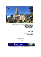
Edwinstowe Church and the Cult of St Edwin -