Bookings

Community Archaeology Nottinghamshire, Community Archaeology Derbyshire, Community Archaeology Leicestershire, Community Archaeology East Midlands, Mercian Archaeological Services Community Archaeology for Nottinghamshire, Derbyshire, Sherwood Forest, Leicestershire and the East Midlands. Community Archaeology Nottinghamshire, Community Archaeology East Midlands, Community Archaeology Leicestershire. Archaeological

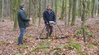
Resistance Survey Geophysics Days at Welby Deserted Village, Leicestershire
Come and undertake a Geophysical Resistance Survey at the Deserted Village of Welby in Leicestershire.
You can book by the day at £35 per day or the special discounted rate of £150 for 5 days.
This is a real hands-
08th to 12th July 2019
Mercian Archaeological Services CIC
Specialists in Community Archaeology, Public Involvement, Research & Training
Community Archaeology Nottinghamshire, Excavation, Research, Volunteering, Community Archaeology Derbyshire, Training, Social, Learning, Community Archaeology Leicestershire, Heritage, Involvement, Belonging, Knowledge sharing, Community Archaeology Lincolnshire, Topographic Survey, Talks and Presentations, Outreach, Archaeology Projects , Open Days, Schools, Finds Processing, Day Schools, Field Schools, Young People, Archaeology and History of Sherwood Forest, Pottery Research, Medieval, Roman, Prehistoric, Community Interest Company, Community Archaeology Nottinghamshire.
Community Archaeology in Nottinghamshire
Community Archaeology in Derbyshire
Community Archaeology in Leicestershire
Community Archaeology East Midlands
Community Archaeology in Lincolnshire
© Mercian Archaeological Services CIC 2013. Registered Business No. 08347842. All Rights Reserved.
Payment options:
- You can book your place for any of the days listed below, and clicking each ‘add to cart’ button.
- When you have selected all the required days click on the view cart button to proceed to checkout.
- If you wish to take advantage of the discount offer of all 5 days for £150 please click on the ‘buy now’ button below.
- Alternatively you can pay by direct bank transfer or by cheque.
- To do so please email us at info@mercian-
as.co.uk to arrange the required days and payment methods.
Places are limited so please book promptly to avoid disappointment.
Bookings

View your Shopping Cart

Or book all 5 days for the discounted price of £150

Book your place(s) by using the online payment
Geophysical Resistance Survey
Come and have a go at Geophysical Resistance Survey and help out with mapping the site of Welby Deserted Village in Leicestershire.
Resistance survey is an active geophysical technique based on the passing of an electrical current through the ground and the measurement of the resistance to its current (Gaffney & Gater 2006). The main influence on the level of resistance of subsoil material to an electrical current is the moisture content and porosity. The archaeological theory is based on the fact that ‘dry’ features such as walls and compacted features such as metalled surfaces or floors will demonstrate relatively high resistance. Opposite to this ‘wet’ ditches and pits which have a more silt-
The surveys and reporting will be conducted in accordance with English Heritage guidelines, Geophysical survey in Archaeological Field Evaluation (David, Linford & Linford 2008); the Institute for Archaeologists (IfA) Draft Standard and Guidance for archaeological geophysical survey (2010); the IfA Technical Paper No.6, The use of geophysical techniques in archaeological evaluations (Gaffney, Gater & Ovenden 2002); and the Archaeology Data Service Guide to Good Practice: Geophysical Data in Archaeology (draft 2nd edition, Schmidt & Ernenwein 2010).
All attendees will get to undertake the survey and use all equipment.

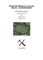
View the Desk-
Deserted Medieval Village of Welby, Leicestershire.
Desk-
Prepared by L. Saunders. 2017. Project Code -
The Deserted Village of Welby is being surveyed as part of a long -


About the site
The Deserted Village of Welby is situated 3km to the north-
The site “sits within a historically rich landscape with close proximity to prehistoric and Romano-
The now deserted village of Welby formed one of the original group of five hamlets, which lay round the Anglo-
The earliest reference to Welby is within the Great Domesday Book c.1086 A.D., when it was referred to as 'Alebie’ and 'Alebi'. This name is of Scandinavian origin -
Within the close vicinity (i.e.: within 500 metres) there is evidence of Bronze Age, Iron Age and Romano-
Previous investigations on the site have uncovered pottery which has been identified of Saxo-
It is not known whether this 'Saxo-
“A hollow-
Other potential related sites include fishponds to the north-
There is much potential interest in the site due to a large right angled ditch detected by Force Archaeology in 2017:
“A Field walk in January 2017 by members of the Force Archaeology and Heritage Society (previously known as Operation Nightingale Heritage) noted a substantial bank running North/South some 100 metres in length. 20 metres from the North end of the bank was a gap of 5 – 10 metres which had the appearance of an entrance. At the Southern end the bank turned 90 degrees East for a further 100 metres before it disappeared into the adjoing Industrial Business Park. An external ditch ran parallel to this bank. At the corner the height differential was 1.5 metres. It was significant in that the corner was rounded, reminiscent of those seen in Roman Army forts” (Saunders 2017).
Aerial Photograph-
Aerial Photograph-

Designed to work with the Archaeology Skills Passport
A topographic survey of the site using Differential Survey-
Attendees will be instructed in how to use all equipment and will learn about the techniques and how these are employed in the field. Attendees will also learn about site logistics and how to set out a geophysical survey using tapes and canes, and help with setting out grids around the site to undertake the survey.
*Please note, no lunch or transport is provided*